How A Marine Lecturer Uses Drones To Monitor Coastal Erosion in Ghana

By now, drones are no more a mirage, as these devices have made entries into African markets, being used for different purposes ranging from distribution to videography and recreation. When these gizmos made their first African appearances, they were more or less perceived as one of the new weapons to be used to stir fear, but as time lapsed, even the common man understood the need and harmlessness of these airborne devices.
Drones are affordable, easy to operate and efficient at tasks when appropriately used. These upsides are perhaps why a marine lecturer at the University of Ghana deems drones as reliable tools he can leverage to monitor and study the coastal erosion in Ghana.
Delta environments are low-lying and substantially open to attacks from flooding and erosion by ocean waves, and these threats are assumed to increase alongside the rise in global climate change concerns and sea levels. In order to closely observe these dangers and their impact with quality, high-resolution outputs coming from tools that can be deployed speedily and frequently, drones become important in the development of strategies that will protect communities living close to these ill-boding deltas.
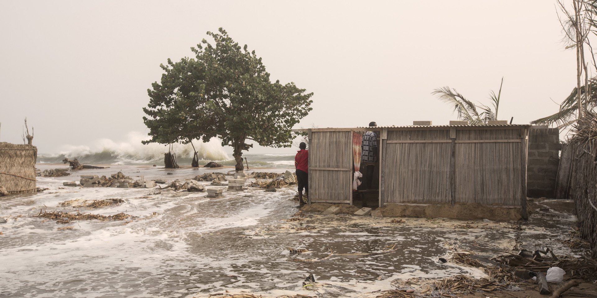
Kwasi Addo Appeaning and his crew from the Marine and Fisheries Sciences Department in the University of Ghana use drones to monitor flooding in a vulnerable coastal community called Fuvemeh which is located in the Volta Delta along the eastern coast of Ghana – the hotspot for erosion and flooding.
Despite the frequency and intensity of the hazards increasing in recent years, there’s the absence of warning systems and effective monitoring which doesn’t give these vulnerable regions the room to get prepared for what may befall their terrain. Traditional methods of flood monitoring, such as aerial photos and ground surveying, which contribute to the unpreparedness of places like Fuvemeh, can be big-ticketed as it demands specialised training and professional execution. But drones, being the saving grace in these situations, are inexpensive and easy to operate.


Coupled with their high-resolution outputs, they can give quality depictions of Ghana’s coastline.

DJI Phantom 3 Drone. Courtesy: Cnet
Drones are unmanned airborne devices which can be operated remotely or flown automatically at defined altitudes, used to capture and record certain data. Kwasi Addo and his team used a DJI Phantom 3 drone, which is equipped with an HD camera to capture aerial videos and images from Fuvemeh’s skies, collecting the region’s coastal data from August 2016 to June 2017.
In a bid to detect and measure short-term changes in the shoreline position and evaluate the flooding impact on the community, they took and analysed the drone’s outputs alongside satellite images from 2014 and photographic maps from 2005.

According to the lecturer, the drone images revealed the severe impacts flooding and erosion had on the Volta delta as well as the Fuvemeh community. For 12 years, out of about 375,229 meters square land area, which comprises 37 percent of the land mass, has been wiped by erosion.
In some areas, the shoreline had moved several meters towards land and even up to 100 meters in others. This resulted in the wreckage of 77 houses – which makes up 42 percent of real estate in the Fuvemeh community. The only school in the community was also washed to ruins, and people’s livelihoods were marred as farmlands and plantations were taken over and obliterated by the floods.
Even Fuvemeh’s local fishing businesses lost their fish landing sites which were eventually closed down, rendering people jobless. Facts collected from the community by the team of researchers show that 300 people have been displaced because of the deadly environmental shifts.
If solutions are to be availed to solve these problems, a drone can immensely assist in monitoring the situation, because the devices can go without people, can quickly be manoeuvred and effective in collecting information regarding the coast’s environmental disaster as it unfolds.
Courtesy: features.foreignpolicy.com
Upon contact, Professor Kwasi Addo told WeeTracker that he is hopeful the government of Ghana will support in the further development of drones to monitor similar situations and bring about more solution both within and around the coastal areas. He also expressed his concern regarding the current state of things in the Fuvemeh community, with hopes that the government would soon intervene and make life a lot less hazardous for the residents.
“I am sure the government will support our cause, alongside many others in order to; prevent such environmental hazards and liberate the people of Ghana,” he said.
The DJI Phantom 3 has helped Kwasi Addo and his team notice when larger waves and high tides occur. Because the land is only 2 meters above sea level, they can notice these changes and quickly alert residents of the Fuvemeh community to brace for impact – thanks to science. According to the lecturer, drones are also useful when it comes to long-term monitoring to produce coastal studies, especially the ones that examine sea level rise and fall, the height of waves and the changes in shoreline positioning. Drones have proven to be more effective in these ramifications compared to older methods.
Physical surveying does generate maps with the position of physical features as well as how they are influenced by flooding. The maps deliver accurate data as per change detection with the aid of a physical surveyor all through the data collection period. But physical surveys, as you may have noticed, are time-consuming and expensive, not to mention the human errors that affect its reliability.
Aerial photographs also provide great spatial coverage and are commonly used, but they lack timeliness and are very site specific. Even satellite imagery which has massive area coverage and provides detailed, high-resolution data yet produce images altered by cloud coverage, dust, pixel resolution, and even operational costs.
When accuracy, cost, and duration of these various alternatives are assessed, drones emerge the no-brainer for good image and video solutions. They cost little to handle, allow for frequent flights, deliver spatial coverage and collect quality data.
The information produced by drones can help in the determination of short-term and long-term benefits in the splash and wash zones of the coastal erosion in Ghana. As the professor expressed in an interview with WeeTracker, “The Fuvemeh community is yet to be helped by the government, but my team and I believe the data obtained from the drone during the survey will be looked into and used to bring a lasting solution to flooding and erosion in the region.”
Communities such as Fuvemeh, as a result of these studies, will come to have action-on-ground, sustainable approaches to increase their resilience. Solutions such as defensive sea structures and sand loss replacement (with other materials) may need to be implemented to survive the ravages of erosion and flooding.